Before a single shot is fired, modern wars are already being fought in the air quietly. Not by fighter jets or attack helicopters, but by unmanned aircraft that most people never notice. These aircraft don’t carry bombs or missiles. Instead, they watch, listen, and report.
In today’s armed forces, ISR drones have become one of the most valuable military assets. They provide commanders with real-time information, reduce risk to pilots, and help armies make smarter decisions on the battlefield. In many operations, winning starts with knowing more than the enemy and that is exactly where ISR drones come in.
According to Grand View Research, during the period from 2024 to 2030, the global ISR market will nearly double to USD 49.5 billion, growing at a strong 11.3% CAGR. North America will lead revenues, with India emerging as the fastest-growing market.
What Are ISR Drones?
ISR stands for Intelligence, Surveillance, and Reconnaissance. An ISR UAV is a military drone designed not to attack, but to gather information.
These drones are used to:
- Monitor enemy movement
- Track vehicles, ships, or troops
- Observe border areas and conflict zones
- Collect signals and electronic data
Unlike combat drones, military ISR UAV systems focus entirely on awareness. Their job is to see what is happening, where it is happening, and sometimes who is involved without being detected.
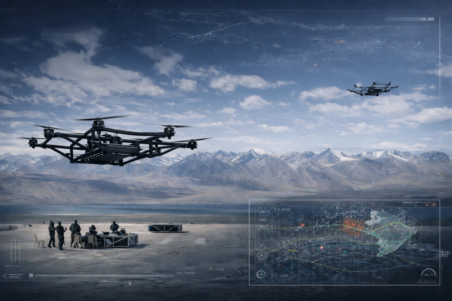
How ISR Drones Work in Real Military Operations
In real operations, ISR drones often fly long before ground forces move in. They operate at high altitude or long distance, staying in the air for hours or even days.
A typical mission looks like this:
- The drone is launched from a ground station or airbase
- Operators control it remotely or through pre-planned routes
- Sensors scan the area below continuously
- Live data is transmitted back to command centres
This live feed allows military leaders to adjust plans instantly. If a threat appears, routes can change. If a target moves, forces can follow it without ever being seen.
From experience in the aerospace sector, this ability to stay airborne for long periods is what truly separates ISR drones from traditional aircraft.
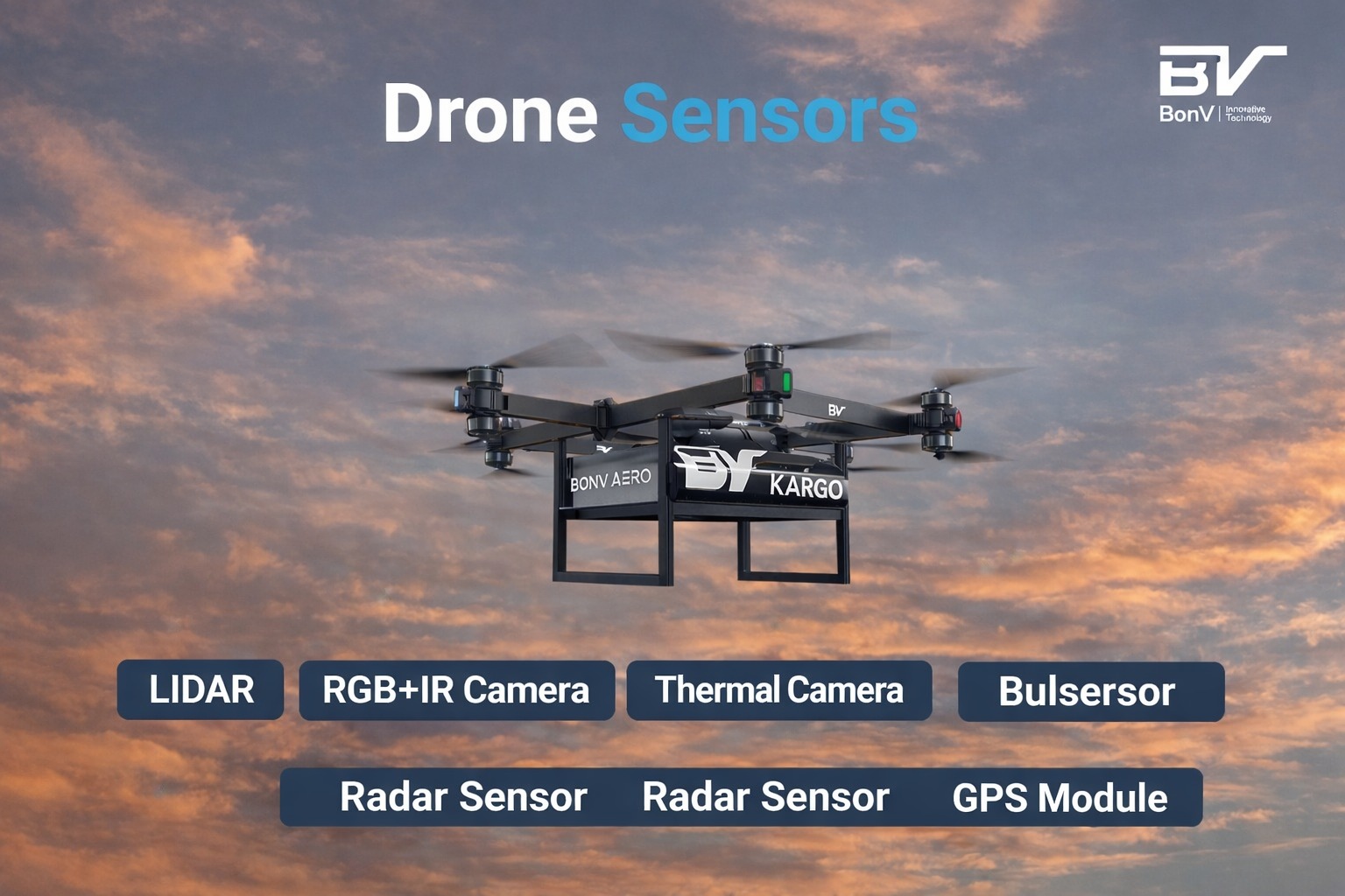
Sensors Used in ISR Drones: The “Eyes” of the Battlefield
The strength of military surveillance drones lies in their sensors. These are the “eyes” that allow them to operate day and night, in almost any environment.
Common sensors include:
- Electro-optical cameras for clear daytime imagery
- Infrared sensors to detect heat signatures at night
- Thermal imaging to spot hidden vehicles or personnel
- Radar systems for wide-area monitoring
Some advanced ISR UAVs can zoom in on objects from tens of kilometres away. Others can track movement patterns over time, helping forces understand enemy behaviour rather than just location.
Communication Interception & Signal Tracking: The “Ears” of ISR Drones
ISR drones don’t just watch, they listen.
Many military ISR UAV systems are equipped to detect and analyse electronic signals. This includes:
- Radio communications
- Radar emissions
- Mobile or satellite signals
By intercepting these signals, ISR drones can identify enemy units, command centres, or communication networks. This electronic intelligence often reveals more than visual data alone, especially when targets are hidden or camouflaged.
This is why ISR drones are often described as the “ears” of the modern battlefield.
Types of ISR Drones Used by Armed Forces
Armed forces use different ISR drones depending on mission needs.
Tactical ISR drones
- Short-range
- Used by ground units
- Ideal for battlefield awareness
Medium-altitude long-endurance (MALE) drones
- Operate for 24+ hours
- Used for regional surveillance
- Common in border and counter-terror missions
High-altitude long-endurance (HALE) drones
- Fly above commercial air traffic
- Cover massive areas
- Used for strategic intelligence
Each type plays a role in maintaining constant visibility across land, sea, and air.
ISR Drones vs Manned Reconnaissance Aircraft
One common question is the difference between ISR drones and manned reconnaissance aircraft.
The key differences are:
- Risk: ISR drones remove pilots from danger
- Endurance: Drones can stay airborne much longer
- Cost: UAVs are cheaper to operate and maintain
- Stealth: Smaller drones are harder to detect
Manned aircraft still have a role, especially for rapid response missions, but for long-duration surveillance, ISR UAVs are now the preferred choice.
According to NewsTrail Intelligence, Surveillance and Reconnaissance (ISR) drones account for a significant share of total military UAV deployments, often cited as making up to 40 % of defence drone applications in 2025 due to persistent surveillance needs.
Role of ISR Drones in Modern Warfare
The role of ISR drones in modern warfare extends well beyond simply watching the battlefield. These systems act as the central nervous system of military operations.
- Precision airstrikes: Before an airstrike is approved, ISR drones are often the first assets deployed. They confirm target location, track movement patterns, and identify civilian presence nearby. Even after a strike, ISR UAVs remain in the air to assess damage and confirm whether objectives have been achieved. This reduces unnecessary follow-up strikes and helps avoid collateral damage.
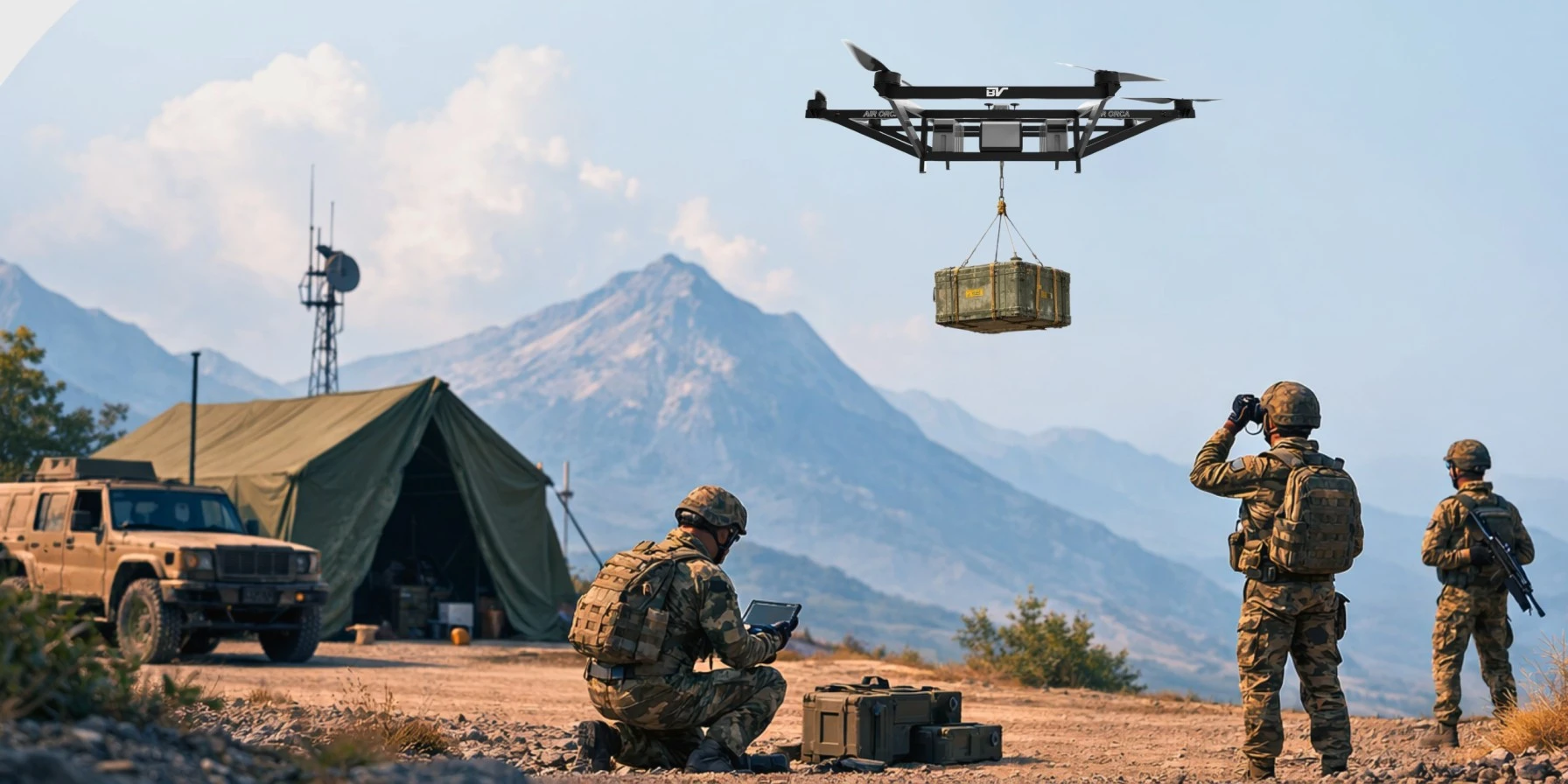
- Support for ground troop movement: For troops on the ground, ISR drones provide live visibility beyond natural line of sight. They scan roads for ambushes, monitor building rooftops, and track enemy patrols in real time.
This allows commanders to choose safer routes, time their movements accurately, and react quickly if the situation changes. In many operations, ISR drones effectively become an extra set of eyes for soldiers operating in hostile environments. - Naval and maritime operations: At sea, ISR drones play a critical role in monitoring shipping lanes, coastal regions, and exclusive economic zones. They track suspicious vessels, support anti-piracy missions, and assist submarines and surface ships with situational awareness.
Their ability to stay airborne for long durations makes them particularly valuable for wide-area maritime surveillance. - Logistics planning and supply route security: One of the lesser-discussed but vital roles of ISR drones is in military logistics. Before supply convoys move, ISR drones survey routes for threats such as roadside explosives, hostile checkpoints, or enemy activity.
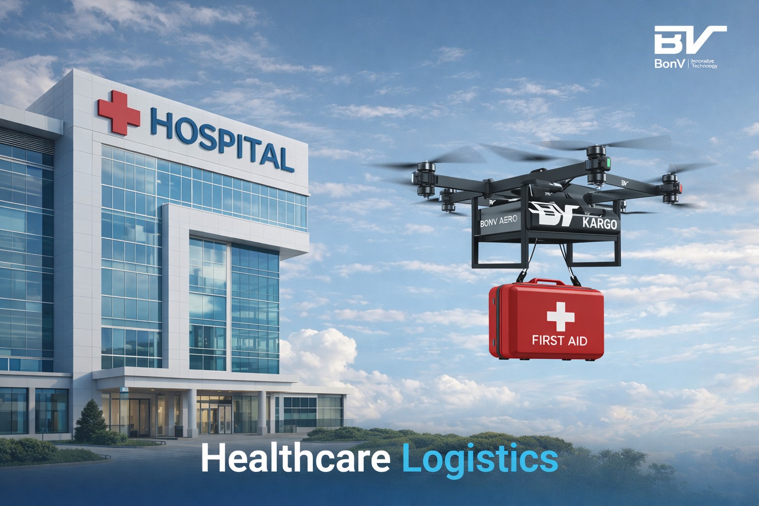
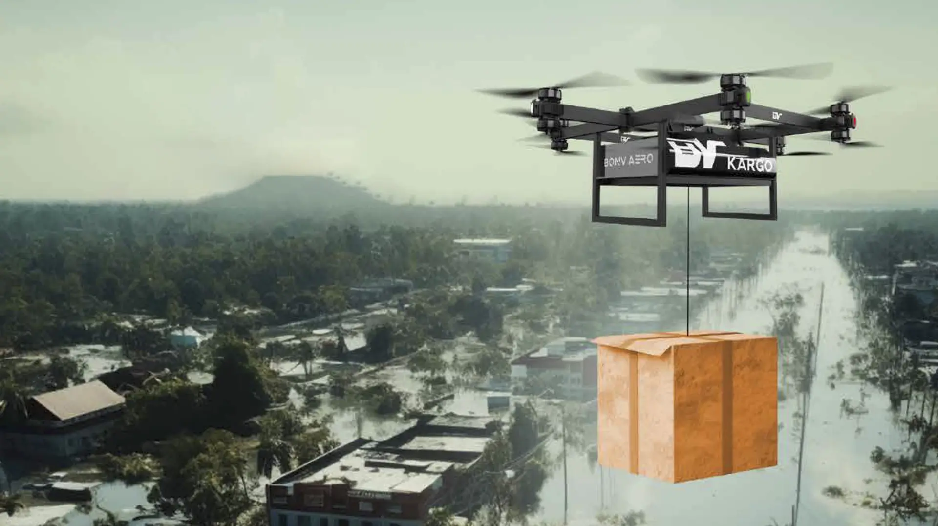
During operations, they help monitor fuel, ammunition, and medical supply movement, ensuring that logistics chains remain secure and uninterrupted. This intelligence is especially important in remote or contested regions where traditional reconnaissance is limited. - Disaster response and humanitarian missions: Beyond combat, ISR drones are widely used in disaster relief and humanitarian operations. They assess damage after natural disasters, identify accessible routes for aid delivery, and locate stranded civilians. In conflict zones, they help coordinate evacuation efforts and monitor ceasefire conditions without placing personnel at risk.
In modern conflicts, ISR drones often determine when action should take place, where resources should be deployed, and how risks can be minimised.
AI and Automation in ISR Drones
Artificial intelligence is changing how ISR drones collect and process information. Instead of relying entirely on human operators, modern systems now use AI to analyse data as it is captured.
- Automatic target detection: AI enables ISR drones to identify vehicles, vessels, and human movement automatically, reducing the need for constant manual monitoring.
- Pattern recognition: By analysing repeated movements and behavioural changes over time, AI helps spot unusual activity that may indicate emerging threats.
- Real-time threat alerts: When a potential risk is detected, the system sends instant alerts to operators, allowing quicker and more informed decisions.
- Intelligent data filtering: AI filters large volumes of video and sensor data, showing analysts only what matters and reducing information overload.
From an aerospace operations perspective, AI-driven automation is rapidly reshaping ISR drone capability, making surveillance faster, smarter, and more reliable.
Challenges and Limitations of ISR Drone Operations
- Vulnerability to electronic jamming: ISR drones rely heavily on data links and signals, which can be disrupted by electronic warfare systems, limiting communication and control.
- Dependence on satellite communication: Many long-range ISR UAVs depend on satellite links for command and data transfer, making them vulnerable if those links are degraded or denied.
- Weather and environmental constraints: Harsh weather, strong winds, and low visibility can affect sensor performance and flight endurance, especially in complex terrain.
- Legal and ethical concerns: Continuous surveillance raises questions around privacy, airspace use, and rules of engagement, particularly in non-combat or civilian-populated areas.
- Emerging counter-drone technologies: Adversaries are increasingly investing in radar, electronic warfare, and air defence systems designed specifically to detect and neutralise ISR drones, making operations more challenging.
Despite these limitations, ISR drones remain a critical asset, with ongoing advancements aimed at improving resilience and survivability in contested environments.
ISR Drones as a Strategic Force Multiplier
Modern military power is no longer defined only by firepower, but by information and awareness.
ISR drones give armed forces the ability to see further, respond faster, and make better decisions in complex environments. From our perspective as a drone manufacturing company in India, it is clear that advances in sensors, endurance, and intelligent systems are rapidly strengthening ISR capabilities.
In future conflicts, the side that controls the skies with ISR UAVs will shape the battlefield often before the enemy even realises they are being watched.

Gaurav Achha is Co-Founder & Co-CEO of BonV Aero. With a background in aerospace, AI, and business, he brings global experience and a passion for building next-gen aerial systems that solve real-world mobility challenges.