UAV vs Drones: Complete Guide to Types, Uses, and Technology

Technology is moving faster than ever, and one of the most exciting developments in recent years has truly been in the skies. We’re talking about aerial innovation, particularly Unmanned Aerial Vehicles (UAVs) and drones. Whether it’s snapping stunning aerial photos, delivering parcels, monitoring crops, or even supporting military operations, these flying machines are changing the way we live and work.

But what exactly are UAVs and drones? Are they the same thing? And why should businesses, hobbyists, and tech enthusiasts even care?

In this guide, we’ll break it all down starting with the basics, exploring how they’re used in the real world, and looking ahead at where this technology is heading.

What Are UAV and Drones?

Understanding the difference starts with getting the terms right. While often used interchangeably, UAVs and drones have slightly different meanings.

UAV

A UAV, or Unmanned Aerial Vehicle, refers to an aircraft that operates without a human pilot on board. UAVs are typically controlled remotely or follow pre-programmed flight paths using onboard systems. The term “UAV” is often used in military, research, or industrial contexts where precision, autonomy, and mission complexity are high.
UAVs are part of a broader system known as UAS (Unmanned Aircraft System), which includes the aircraft, ground control systems, sensors, and communication links.

Drone

A drone is a more casual or consumer-friendly term for the same type of device. Originally used to describe any remotely piloted vehicle (air, ground, or water), “drone” now commonly refers to multirotor flying devices used for photography, leisure flying, or small-scale commercial applications.

While every drone is technically a UAV, not all UAVs are referred to as drones – especially in formal or defence-related discussions

Are Drones and UAVs the Same?

Technically yes, but the context of use makes a difference.

 Both UAVs and drones refer to unmanned flying machines, but their usage differs based on audience, application, and complexity.

  • “Drone” is the everyday term used by the general public.
  • “UAV” is more technical and used in aviation, military, or commercial industries.

So, while they technically refer to the same thing, using “UAV” usually implies a more sophisticated system, while “drone” might suggest a simpler, hobby-grade device.

Key Differences Between UAV and Drones

FeatureUAV (Unmanned Aerial Vehicle)Drone
DefinitionTechnical term for unmanned aircraftGeneral/public term for flying robots
Usage ContextMilitary, industrial, scientificConsumer, entertainment, small commercial
Flight ControlOften autonomous or long-range remote-controlledTypically manually controlled via app/controller
System IntegrationPart of a full UAS (includes control, sensors, data)Often standalone unit
Cost & ComplexityHigh cost, advanced componentsVaries from low-cost toys to prosumer drones
ExamplesSurveillance UAVs, mapping drones, delivery UAVsDJI drones, toy drones, vloggers’ drones

Types of UAV and Drones

There are many different types of UAVs and drones depending on their design, purpose, and flying capabilities. Here are the main categories:

  • Fixed-Wing UAVs: Fixed-wing UAVs look like traditional aeroplanes. They can cover long distances and stay in the air for longer periods, making them ideal for large-area mapping, surveillance, and military use. However, they need runways or a launch system to take off and land.
  • Multirotor Drones: These are the most popular drones you’ll see – like quadcopters and hexacopters. They can hover, take off vertically, and are easy to fly, which makes them perfect for photography, videography, and inspection tasks. Their flight time is usually shorter compared to other types.
  • VTOL (Vertical Take-Off and Landing) Drones: VTOL drones combine the features of both fixed-wing and multirotor drones. They can take off and land vertically like a helicopter but fly forward like an aeroplane. This makes them useful in places with limited space and for long-distance flights.
  • Nano and Micro Drones: These are very small drones often used indoors, for research, or in military surveillance. They can enter tight spaces and are usually lightweight and easy to carry. Their flight time and range are limited but useful for specific tasks.
  • Hybrid UAVs: Hybrid UAVs are custom-built to handle complex tasks by combining multiple features – for example, the stability of a multirotor with the endurance of a fixed-wing. They are used in industries that require flexible and reliable flight performance.

How Do UAVs and Drones Actually Work?

UAVs and drones function through a combination of aerodynamics, onboard sensors, GPS navigation, and real-time communication with a remote controller or ground station.

Key Components:

  • Flight Controller: The brain that processes inputs and controls motors
  • Propulsion System: Motors and propellers for lift and movement
  • GPS Module: Enables positioning, altitude hold, and return-to-base function
  • Sensors: Cameras, Light Detection and Ranging, thermal sensors for specific applications
  • Battery: Powers the entire system; flight time depends on capacity

Advanced UAVs may operate autonomously using AI, while consumer drones are mostly operated manually or semi-autonomously via mobile apps.

Where Are UAVs and Drones Used?

UAVs and drones are now used across many industries, helping to save time, improve safety, and collect data in ways that weren’t possible before. Here are some of the most common use cases:

1. Defence and Border Surveillance: In the defence sector, UAVs play a critical role in surveillance, monitoring borders, and gathering real-time intelligence. They allow armed forces to observe hard-to-reach or dangerous areas without putting soldiers at risk.

2. Agriculture: Farmers use drones to monitor crop health, spray fertilizers or pesticides, and map large fields. This helps increase efficiency, reduce costs, and support precision farming practices that improve overall yield.

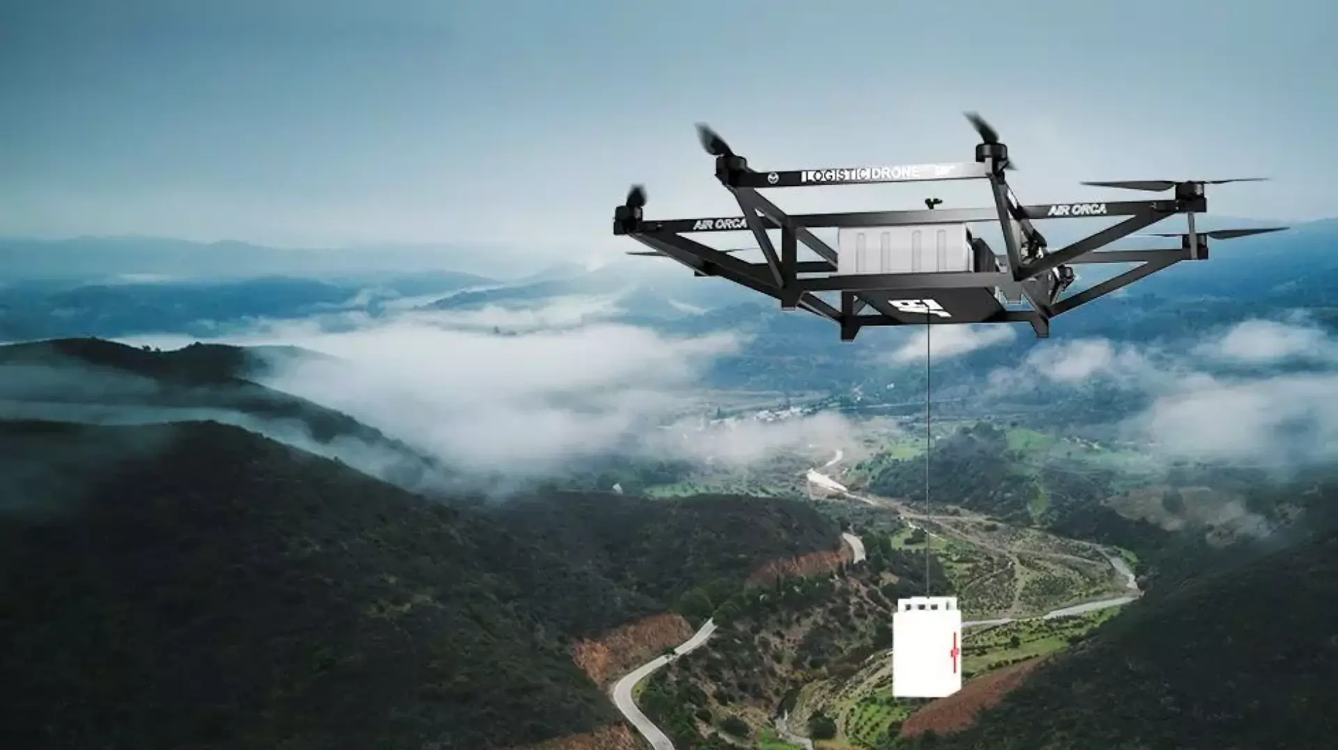
3. Delivery and Logistics: Drones are being tested and used for delivering packages, especially in areas where traditional transportation is slow or difficult. They are ideal for delivering medical equipment or medicines, food, and small goods quickly and safely.

4. Aerial Photography and Videography: Drones have transformed the photography and film industry. They help capture stunning aerial shots for weddings, events, movies, and real estate, offering unique perspectives that were once only possible with helicopters.

5. Infrastructure and Industrial Inspection: Drones make it easier to inspect hard-to-reach structures like power lines, wind turbines, pipelines, and tall buildings. This reduces the need for human workers to perform risky tasks while providing accurate visual data.

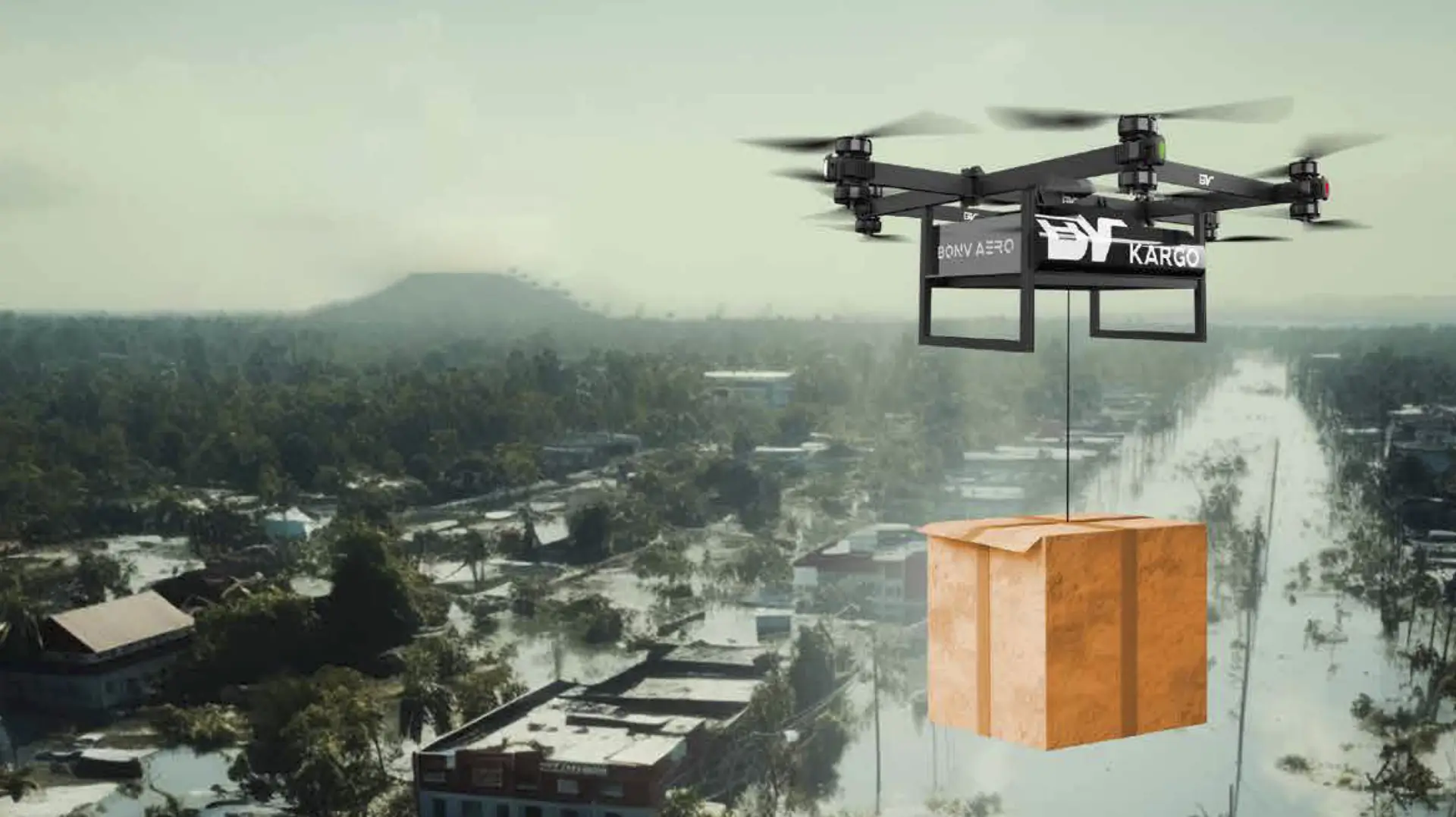
6. Disaster Response and Emergency Services: During natural disasters or emergencies, drones are used to locate victims, assess damage, and deliver aid to areas that are otherwise inaccessible. They support faster response times and help save lives in critical situations.

What’s the Future of UAV and Drone Technology?

The future of UAVs and drones is full of exciting innovations that will make these flying machines even more powerful, efficient, and widely used. Here’s what to expect in the coming years:

1. AI-Powered Autonomous Flights: Drones will become smarter with artificial intelligence, allowing them to fly, detect obstacles, and make decisions without human control.

2. Drone Swarms: Multiple drones will work together in a coordinated way — useful for defence missions, search and rescue, or large-scale farming.

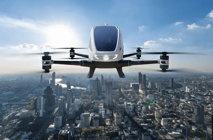
3. Urban Air Mobility (UAM): Drone taxis and air shuttles could become a reality, helping people travel across cities through the sky, reducing road traffic.

4. Medical and Emergency Deliveries: Drones will play a bigger role in delivering emergency medical supplies like blood, vaccines, or medicines to remote or disaster-hit areas.

5. Improved Battery and Flight Time: Advancements in battery technology will allow drones to fly longer and cover more distance, making them more efficient for industrial use.

6. Integration with 5G and IoT: Faster and more reliable data sharing between drones and control systems will improve real-time tracking, communication, and performance.

7. Eco-Friendly Drone Designs: The future will bring lighter, quieter, and more environmentally friendly drones made with sustainable materials and lower emissions.

Are Drones and UAVs Regulated?

Yes, drones and UAVs are regulated to ensure airspace safety and privacy.

In India (DGCA Guidelines):

  • All drones above 250g must be registered.
  • Flying in certain zones (near airports, military areas) is prohibited.
  • Pilot training and Remote Pilot Certificate may be required for commercial use.

In the US (FAA Guidelines):

  • Drones must be registered if they weigh over 250g.
  • Flying beyond visual line of sight (BVLOS) requires special permission.
  • Part 107 licence needed for commercial drone operations.

UAVs and drones are transforming how we work, travel, and understand the world around us – from helping farmers and delivery services to assisting in emergencies and inspecting critical infrastructure.

As this technology continues to develop, it’s important for individuals and businesses alike to stay informed about the latest uses, updates, and safety rules.

At BonV Aero, a trusted drone manufacturing company in India, we focus on developing high-performance UAVs for defence, government, and commercial applications. Our solutions are designed to meet the specific needs of institutional and industrial use cases backed by precision, reliability, and innovation.

If you’re seeking a dependable partner in drone technology for your organisation, we’re here to support your goals with tailored, future-ready solutions.

Case Study: Our Drone Logistics at Girnar with Heavy-Lift Tech

Girnar Hill, located in Gujarat, rises to an altitude of approximately 3,660 ft, and is one of India’s most revered pilgrimage destinations. Every year, over 10 lakh (1 million) pilgrims and tourists visit its five key Tungs (temple peaks), including the Jain Temple Complex, Ambe Mata Temple, the Temple of Saint Gorakhnath, Kalika Temple, and Guru Dattatreya Temple. Steeped in history and spirituality, each Tung adds to Girnar’s rich cultural and religious heritage. 

For centuries, devotees had to undertake an arduous journey, climbing more than 5,000 steps to reach these temples. The Girnar Ropeway, inaugurated in October 2020, has significantly improved access for pilgrims, reducing travel time to just 7–8 minutes. Even with all advancements, one thing hasn’t changed at Girnar Hill, which is related to delivering logistics on the hill. There are no facilities for this, and all things need to be carried by foot, whether it’s daily essentials, temple supplies, or waste management.

Now imagine doing this every single day, in all kinds of weather, up and down those steep steps. It’s physically exhausting, time-consuming, and not always reliable.

This is the core problem we’re solving. Once you truly understand how challenging it is for people and supplies to move up Girnar, you’ll see why our drone solution is not just helpful, it’s necessary. It’s not about replacing people’s efforts, but about supporting them where traditional transport simply can’t go.

Recognising these challenges, BonV Aero introduces Our High-altitude Logistics UAV, a cutting-edge drone logistics aerial vehicle. Designed for extreme terrains and high-altitude operations, it promises to revolutionise logistics at Girnar. By combining advanced drone technology with a sustainable approach, Our Drone ensures reliable and efficient transportation of goods and supplies while preserving the ecological balance and sacredness of this site. 

This logistics drone case study highlights how BonV Aero’s Logistic Drone is improving transport at Girnar. Built for high-altitude and tough terrain, it offers a faster, eco-friendly way to deliver supplies while protecting the site’s spiritual and natural environment.

About Girnar Hill & Its Temples

Neminatha Jain Temple: Starting point, located at ~3,000 ft.

Ambe Mata Temple: Elevated at ~3,500 ft.

  • Distance: ~3 km by road, ~1 km aerial.

Temple Of Saint Gorakhnath: Located at ~3,300 ft.

  • Distance: ~4 km by road, ~1.5 km aerial.

Kalika Mata Temple: Positioned at ~3,800 ft.

Guru Dattatreya Temple: The highest Tung, located at ~3,660 ft.

  • Distance: ~5 km by road, ~2.5 km aerial.

Logistics Challenges on Girnar

  • Rugged Terrain: The steep ascents, sharp elevation changes, and narrow pathways between the Tungs make conventional transport methods labour-intensive and time-consuming. Porters, who regularly carry 20-30 kg loads on their backs, along with animals, serve as the primary modes of transport. However, these methods are limited in capacity, prone to delays, and physically demanding, making logistics increasingly difficult.
  • Elevation Differences: The five Tungs vary significantly in elevation, complicating the transportation of essential supplies like food, water, medical kits, and construction materials. For example, the Jain Temple is located at approximately 3,000 ft, while the Guru Dattatreya Temple sits at over 3,600 ft. Without mechanised transport, moving supplies up the steep slopes is a challenging and labour-intensive process.
  • Unpredictable Weather: Monsoons bring heavy rains that make the pathways slippery and dangerous, while high winds and fog further challenge logistics. Extreme temperatures, ranging from scorching summers to cold winters, add to the difficulty of manual transport, affecting both labourers and animals.
  • Labour Shortages & Construction Delays: Due to the physically demanding nature of the job, only a limited number of porters are willing to take on this work. This shortage of labour slows down construction and maintenance projects at the hilltop, making it difficult to improve facilities for pilgrims and restore heritage structures in a timely manner.
  • Environmental Concerns: The heavy reliance on manual labour, animals, and fuel-powered vehicles contributes to environmental degradation. These methods disrupt the fragile ecosystem and leave a carbon footprint that threatens the area’s natural beauty.
  • Time Constraints: Traditional logistics can take hours to transport goods between Tungs. This delay is particularly problematic for emergency supplies like medical aid or repair materials needed during festivals and peak pilgrimage seasons.
  • Operational Inefficiencies: The increasing footfall of pilgrims has led to congestion and delays in the supply chain. Managing logistics with limited resources adds pressure to temple authorities and impacts the overall experience for visitors.

How BonV Delivers

  • Faster and Reliable Deliveries: Our drones reduce delivery time compared to traditional methods, navigating challenging terrains quickly and autonomously.
  • Resilient in Extreme Weather: Their robust design, including its ability to operate in temperatures from -20°C to 55°C and withstand wind speeds up to 40 km/h, ensures functionality in harsh conditions.
  • Zero Carbon Emissions: We operate without emitting greenhouse gases, offering an eco-friendly logistics solution.
  • Cost-Effective Operations: Drones eliminate the need for extensive manual labor and reduce reliance on traditional fuel-based vehicles, cutting costs.
  • Versatile Payload Capacity: With modular pods and payload options ranging from 10 to 40 kg, we cater to a wide variety of logistics needs.
  • Autonomous and Efficient Flights: Equipped with BVLOS capabilities and self-flying technology, our drones ensure minimal human intervention while maintaining high precision and efficiency.

Our Logistic Drone Enabling High-Altitude Deliveries in India

Our high-altitude logistics drone represents the future of drone deliveries. Designed, developed, and manufactured indigenously by BonV Aero, it is tailored for high-altitude operations, ensuring reliability in rugged terrains.

Key Features

  • Payload Capacity: Modular pods capable of carrying 10-20 kg (scalable to 40 kg).
  • Altitude Capability: Operates efficiently at 15,000 ft AMSL, ideal for Girnar’s elevations.
  • Autonomous Operations: Equipped with Beyond Visual Line of Sight (BVLOS) and self-flying systems for efficient and safe deliveries.
  • Robust Design: Built with aerospace-grade aluminum alloy for durability and longevity.
  • Fail-Safe Mechanisms: Automatic handling of low battery, communication loss, and adverse weather.
  • Ground Control Station (GCS): Enables real-time monitoring, autonomous flight planning, and encrypted communication.
  • Operational Versatility: Capable of night operations with infrared cameras and weather-resistant features.

How Our Drone Helps on Girnar Hill

Proposed Use Cases:

  • Medical Support: Immediate delivery of first-aid kits and emergency supplies to pilgrims.
  • Infrastructure Development: Transport of lightweight construction materials for washrooms, medical rooms, and other facilities.
  • Pilgrim Welfare: Efficient delivery of food, water, and other necessities to remote temple areas.
  • Disaster Management: Quick relief operations during landslides or extreme weather events.

Our High-Altitude Drone Impact

  • Neminath Jain Temple to Guru Dattatreya Temple:
    • Traditional: 4 hours.
    • Only 2 minutes from one temple to another.
  • Ambe Mata Temple to Gorakhnath Temple:
    • Traditional: 1.5 hours.
    • Only 2 minutes from one temple to another.

Performance and Capabilities

FeaturesDetails
Payload Capacity10-20 kg
Payload CapacityUp to 15,000 ft AMSL
Flight ModesSelf flying Mode, Manual Mode, Return-to-home
Charging TimeLess than 2 hrs
CameraDay and Night Camera
Payload Drop MechanismModular Dropping, Parachute Dropping
Take off and Landing Area10m x 10m
Operating Temperature-20°C to 55°C
Wind/Gust ResistanceUp to 40kmph
Operating Crew2 (1 Pilot + 1 Ground Crew)

Comparative Analysis: Traditional Logistics vs. Our Logistic Drone

AspectTraditional LogisticsOur Logistic Drone
Time Efficiency3-4 hours per delivery~5-10 minutes
CostHigh (labour, vehicles)Reduced operational costs
Environmental ImpactHigh carbon emissionsZero emissions
Payload LimitationsRestricted by manual labourUp to 20 kg per trip
AccessibilityLimited by terrainTerrain-independent

Economic Impact and Benefits

1. Reduced Logistics Cost Over Time

  • While initial drone deployment may require investment, Our system drastically reduces recurring expenses like porter wages, animal upkeep, fuel, and manual transport infrastructure maintenance.
  • Autonomous operations mean fewer personnel are needed for daily logistics.

2. Faster Supply Chain: Quick delivery of temple supplies, food, and medical aid leads to more efficient operations and better service to pilgrims, translating into higher visitor satisfaction and repeat visits.

3. Boost to Pilgrim-Driven Local Economy

  • Improved logistics support allows more timely stocking of food, beverages, and essentials for vendors and temple shops. This helps boost sales and enhances the livelihood of locals.
  • Enables smooth operation of temporary stalls, events, and religious festivals.

4. Support for Infrastructure Projects: Faster and more reliable delivery of materials (bricks, water tanks, tools) accelerates construction and maintenance, helping complete projects sooner and avoid cost overruns.

5. Waste Management Efficiency: Reduced manual load and quicker evacuation of waste using drones improves cleanliness, making the site more attractive for tourists, and lowering sanitation-related costs.

6. Disaster Readiness: In cases of landslides or extreme weather, the drone can quickly resume supply lines, preventing major economic losses due to shutdowns or emergency rescues.

7. Tourism Revenue Growth: Enhanced safety, convenience, and services make the site more attractive to senior citizens and families, leading to longer stays and increased spending in the local hospitality sector.

8. Scalable Use Across Similar Sites: The same Drone system can be replicated at other pilgrimage or hilly tourist locations across India, lowering deployment cost per site and creating economies of scale.

A New Era in Hilltop Transportation

The spiritual and cultural significance of Girnar deserves logistical solutions that match its reverence and scale. BonV Aero’s Autonomous Drone System offers a future-ready alternative, with its autonomous capabilities, heavy payload capacity, weather resilience, and zero-emission operations. It not only alleviates the physical burden on workers and animals but also introduces a more scalable, sustainable, and responsive approach to serve pilgrims, temple authorities, and support teams.

As Girnar continues to attract millions of visitors annually, integrating aerial logistics can vastly improve operational efficiency, preserve the environment, and uphold the sanctity of this sacred hill while also setting a precedent for heritage sites across India.

BonV Aero is committed to supporting such transformation with cutting-edge drone solutions engineered for impact, accessibility, and reliability because no place of faith should be out of reach.

What is a VTOL Drone? Types, Advantages, and Industry Use Cases

There has been a rapid-fire advancement in drone technology, and the most provocative invention is the VTOL drone. Unlike copters, these drones can fly vertically, just like a helicopter, and can also fly forward like an airplane. Since they do not bear a runway, they can cover long distances efficiently.

This blog will explain VTOL drones, what they are, how they work, what types they come by, their strengths and weaknesses, and how they’re used in real life situations.

What is a VTOL Drone?

VTOL stands for Vertical Take-Off and Landing. A VTOL drone is a type of UAV drone that can take off, hover, and land vertically, like a helicopter, and then transition into horizontal forward flight, like an airplane. This dual-mode operation makes VTOL drones unique and highly efficient.

Unlike traditional fixed-wing drones, which require runways or catapults to launch and land, VTOL drones can operate in tight or remote areas – fields, rooftops, forest clearings, or even boats. At the same time, they offer the long range and energy efficiency of fixed-wing aircraft.

VTOL technology is especially useful in:

  • Areas with limited space for takeoff or landing
  • Missions that require both hovering and long-distance coverage
  • Applications where flight endurance and precision are equally important

What is the difference between VTOL and eVTOL?

While both terms sound similar, VTOL and eVTOL serve different purposes:

  • VTOL Drones: These include any drone that can take off and land vertically, powered by any energy source (battery, fuel, or hybrid).
  • eVTOL Drones: The “e” stands for “electric.” These are electric-powered VTOL aircraft, often designed for passenger transport, cargo delivery, or urban air mobility (UAM).

So, VTOL is a broader term, while eVTOL refers specifically to electric-powered models, especially in aviation and air taxi innovations.

How does a VTOL drone work?

VTOL drones rely on a combination of vertical lift and forward propulsion. They typically use multiple rotors to take off and land vertically, and then switch to fixed-wing flight for forward motion.

In hybrid VTOL drones, motors tilt or switch off during transition to fixed-wing flight, enabling longer endurance and higher speed. This makes them especially valuable in missions that require covering large areas quickly and efficiently.

Flight control systems, gyroscopes, and GPS modules manage the transition phase between vertical and horizontal flight – one of the most technically challenging aspects of VTOL technology.

What are the different types of VTOL UAV?

VTOL drones come in several types, each designed for different uses based on how they fly and what they’re built for. Understanding these types can help you choose the right drone for your specific needs.

1. Multi-Rotor VTOL Drones

Multi-rotor VTOL drones are the most common and simple type. They have multiple rotors – usually four (quadcopter), six (hexacopter), or eight (octocopter) – that allow the drone to take off, hover, and move in any direction.

These drones are known for their stability, precise control, and ability to hover in one spot, making them ideal for photography, inspections, and small-area surveys. However, because all movement relies on the rotors, they consume more battery power, resulting in shorter flight times and limited range.

2. Fixed-Wing VTOL Drones

Fixed-wing VTOL drones are designed like small airplanes with wings, but also include vertical rotors for take-off and landing. They lift off vertically using the rotors, then switch to forward flight using the wings, just like an aircraft. This combination makes them more energy-efficient and faster than multi-rotor drones, especially over long distances.

Fixed-wing VTOLs are a great choice for mapping, surveillance, and agricultural monitoring where long-range and flight duration are important. However, they are usually more expensive and may require more complex handling or flight planning.

According to recent market research, the global fixed-wing VTOL UAV market was valued at USD 842 million in 2022 and is projected to grow to USD 4,627 million by 2030, expanding at a CAGR of 23.7% during the forecast period.

3. Hybrid VTOL Drones

Hybrid VTOL drones combine the benefits of both multi-rotor and fixed-wing designs in one smart system. They take off vertically using rotors and then transition smoothly into fixed-wing mode for cruising. This allows them to hover when needed and also fly long distances efficiently, making them extremely versatile. 

These drones are often used in large-scale industrial operations, defence missions, emergency response, and logistics. Hybrid VTOLs are among the most advanced and capable drones available today, offering longer flight time, higher payload capacity, and strong performance in challenging environments.

4. eVTOL Drones

eVTOL stands for Electric Vertical Take-Off and Landing. These drones are powered entirely by electricity and are mostly being developed for urban air mobility, such as passenger air taxis and cargo delivery. While still in the early stages of adoption, eVTOL technology is gaining attention from major companies and governments around the world.

Though not widely used in commercial drone work today, eVTOLs represent the future of transportation and will likely play a key role in logistics and city-to-city travel in the coming years.

What are the advantages of VTOL drones?

VTOL drones offer several practical advantages, making them suitable for a wide range of industries:

  • Operate Without Runways: VTOL drones can launch and land anywhere, from a construction site to a moving vehicle, saving space and simplifying operations.
  • Long-Range and Endurance: Unlike multi-rotor drones, hybrid VTOLs can cover up to 100 km or more depending on design, which is ideal for large area mapping or long surveillance missions.
  • Precision Hovering: Can hover in one spot with GPS accuracy – essential for infrastructure inspection, targeted data collection, and 3D mapping.
  • Higher Payload Capacity: Carry heavier cameras, LiDAR systems, multispectral sensors, or even light cargo – something standard drones often can’t manage.
  • Better Energy Efficiency: Fixed-wing flight mode uses less energy compared to constant rotor lift, extending battery life and reducing downtime.
  • Versatile Mission Profiles: One drone can perform multiple roles, hover for inspection, cruise for mapping, land in rough terrain, or deliver a package.

What are the disadvantages of VTOL aircraft?

Despite their benefits, VTOL drones come with a few challenges that users should consider:

  • High Cost of Purchase: Advanced components, sensors, and engineering make VTOL drones more expensive than basic quadcopters.
  • Complex Maintenance: Transition systems, tilt rotors, and advanced software require skilled maintenance and periodic calibration.
  • Requires Skilled Operation: Although many models are semi-autonomous, planning and executing hybrid missions may require training.
  • Regulatory Challenges: In some regions, VTOL drones fall under complex airspace regulations, especially for long-range or high-altitude flights.

Industry Use Cases of VTOL Drones

VTOL drones are used across industries to improve productivity, safety, and cost-efficiency.

1. Surveying & Mapping: VTOL drones with RTK GPS and high-resolution cameras can map 1000+ hectares in a single flight, reducing field time and labor.

2. Agricultural Monitoring: Farmers use VTOL drones for:

  • Crop health analysis (NDVI imaging)
  • Irrigation monitoring
  • Pest detection
  • Yield estimation
  • They provide real-time, data-driven insights for precision farming.

3. Defense & Border Security: Defence agencies deploy VTOL drones for:

  • Surveillance of sensitive borders
  • Live monitoring in difficult terrains
  • Delivery of essential supplies to troops
  • Their quick launch and long-range flight make them highly dependable.

4. Infrastructure Inspection: VTOL drones reduce the risks of manual inspection for:

  • Power lines
  • Oil pipelines
  • Railways
  • Wind turbines
  • Bridges and dams
  • They deliver high-resolution imagery and real-time alerts.

5. Emergency Response: In natural disasters, VTOL drones help in:

  • Search and rescue operations
  • Delivery of food or medical aid
  • Situational awareness through live video feeds
  • Their ability to fly long distances and land in tight areas makes them essential tools in relief missions.

VTOL Drones vs Traditional Drones

FeatureVTOL DronesTraditional Drones
Take-off/LandingVertical (no runway required)Requires space or launcher
Flight RangeLong (up to 100+ km for hybrid)Short to moderate (1–5 km)
Payload CapacityHigh (up to 5+ kg)Low (up to 1–2 kg typically)
Hovering AbilityYesYes (multi-rotor only)
Use CasesIndustrial, defence, mappingPhotography, short surveys

Future of VTOL Drone Technology

The future of VTOL drones is exciting, with constant innovation and investment. Here’s what to expect:

  • Autonomous Flight Capabilities: Integration with AI and machine learning will allow autonomous mission planning, automated obstacle avoidance, and smart payload management.
  • Urban Air Mobility (UAM): With the growth of eVTOLs, cities may soon see air taxis and cargo drones flying over urban landscapes.
  • Hydrogen & Solar Energy: To solve battery limitations, companies are working on hydrogen fuel cells, solar-powered wings, and ultra-light materials.
  • Integration with IoT and 5G: VTOL drones will connect with smart infrastructure, enabling real-time streaming, predictive analytics, and remote control over long distances.

VTOL drones are changing the way industries operate offering a powerful blend of vertical take-off capability, long-range flight, and adaptability. Whether it’s surveying remote areas, supporting emergency services, or handling logistics in challenging terrains, VTOL technology brings unmatched efficiency and precision.

BonV Aero is a leading UAV drone manufacturer in India, dedicated to building reliable, mission-ready drone solutions for logistics, defence, disaster response, and more.

If you’re exploring how drones can elevate your operations, feel free to contact us – we’d be happy to help you find the right solution for your mission.

What is UAV? Its Types, Use Cases

Unmanned aerial vehicles (UAVs) have surged in popularity over recent years in a variety of industries. Ranging from agriculture to military operations, and from warfare to roadways supervision, UAVs are now a part of our very world. But what exactly is a UAV? How does it differ from a drone? And what are these flying machines for? Let’s break down the basics.

According to Mordor Intelligence, Drones request size is anticipated to reach USD 40.18 billion by 2025 and USD 77.03 billion by 2030, growing at 13.9 CAGR over the cast period (2025- 2030).

What is a UAV?

UAV is an acronym for Unmanned Aerial Vehicle. Put another way, it’s an airplane that can fly without a human being in the cockpit. Instead of piloted, UAVs are either remote-piloted by a human controller, or autonomously controlled via software, sensors, and GPS.

So next time you hear someone talk about a “UAV drone,” It will probably not be some super fancy or boring flying robot, just one that can fly without requiring human assistance.

What are the different types of UAVs?

UAVs vary greatly in size and design, and each has its own use. The following are the principal types of Unmanned aerial vehicles (UAVs):

  • Multi-Rotor: These are the ubiquitous ones and simplistic to use. These have many rotors and are perfect for picture taking, close-up work and indoor flying.
  • Fixed-Wing Drones: These are shaped more like traditional airplanes. They can also travel longer distances and remain in the air longer, qualities making them well-suited for surveying and mapping.
  • Single-Rotor Drones: These look like helicopters but are stronger than multi-rotors. They are also used for freight hauling.
  • Hybrid Drones (VTOL): These have the ability to take off and land in vertical flight (like a helicopter) and transition to horizontal flight (like an airplane). For missions that demand both agility and endurance, VTOL drones offer a balanced solution with advanced capabilities.

User needs to consider the types of UAV to determine the suitable one according to his specific application.

What is the difference between UAVs and Drones?

Yes and no. In casual conversation, individuals employ the terms “drone” and “UAV” interchangeably. Technically, the Unmanned aerial vehicles is only the flying part of the system. A drone typically refers to the entire system that includes the UAV itself, the controller, the sensors and the software that allows it to take to the air. But for the most part the two terms have become interchangeable.

This is why you frequently come across individuals looking up terms like “uav meaning” or “difference between drone and uav” on the Internet. Knowing the technical term is helpful, but for everyday purposes, referring to it as a Unmanned aerial vehicles or a drone is adequate.

How are UAVs used?

There are many applications for Unmanned aerial vehicles (UAVs) stretching from common tasks to more specialized duties. Here are a few of the common functions they serve in different fields:

  • Agriculture: Farmers deploy drones to monitor the health of crops, to spray fertilisers and to chart their fields with incredible precision. It helps them better manage their land and troubleshoot early.
  • Construction: Drones are useful on construction sites to check up on structures, monitor progress and make sure everything is being done on time without ever having to scale scaffolding or rely on crane operations.
  • Delivery: Some businesses are experimenting with drones carrying packages, a use that is particularly valuable in remote or hard-to-reach spots where regular delivery vehicles fail.
  • Mapping: Faster, safer land surveying with UAVs. They’re deployed to map terrain, inspect power lines and monitor forests or mines without putting people’s boots on the ground in risky spots.
  • Search and Rescue: Whether someone is lost in a forest or in the aftermath of a disaster, drones help emergency crews cover more ground, faster, even in harsh weather or difficult terrain.
  • Military and Defence: The military uses UAVs on missions of border security, surveillance, and occasionally for support during combat. Their risk is minimized and they are very much on the ground in real time.
  • Logistics: Both the military and commercial companies rely on UAVs for logistics tasks, such as to carry medical supplies, tools, or replacement parts between bases, warehouses or remote sites. In defense, that means advancing troops through difficult terrain. In business, it might refer to quick delivery within extensive industrial parks or among facilities.
  • Cinematography: Drones have transformed the way motion pictures, documentaries and commercials are filmed, delivering seamless shots from aloft that once required helicopters, cranes or planes.

These instances really highlight how versatile Unmanned aerial vehicles (UAVs) can be used, whether it’s for saving time, increasing safety or providing access to locations which would normally be hard to reach.

What are the advantages of UAVs?

UAV Drones also offer various advantages:

1. Enhanced Streamlined Operations

  • With UAVs, tasks can be completed faster and more efficiently than manually.
  • It is ideal for large-scale surveys, inspections, and mapping.

2. Improved Safety

  • The need for human presence in risky environments like disaster zones and inspections at high altitudes has been reduced.

3. Cost-effective Solutions

  • Compared to the usual ways, it requires less fuel, manpower, and equipment.
  • Ideal for budget-conscious projects with large coverage areas.

4. Smart Logistics and Delivery

  • Improves last-mile delivery in remote or congested areas.
  • Improves time-sensitive operations by supporting real-time tracking.

5. Real-Time Monitoring of Data

  • Provides instant aerial footage and analytics.
  • Provides a faster response time for emergency situations, logistics coordination, and resource planning.

What are the drawbacks of UAVs?

However, besides the mentioned advantages, UAVs also have some disadvantages:

  • Battery Life: Very few small drones can fly for 20 to 40 minutes before they need a recharge.
  • Weather: Strong wind, rain or snow can reduce the ability of UAVs to fly.
  • Payload Capacity: Smaller UAVs are not able to carry heavy loads.
  • Privacy and Safety: Unauthorized flying of drones near people or in sensitive areas can raise concerns about privacy and security.

Do I have to go through any certification or registration before flying a UAV?

Yes, all drone flights in India are controlled by the DGCA (Directorate General of Civil Aviation). As per the DGCA drone rules, if your UAV weighs above 250 grams, you have to register it. You need a UIN (Unique Identification Number too and you can only fly in allowed areas.
For commercial operations, you may also need a Remote Pilot Certificate (RPC) depending on the category of the drone and what you want to use it for.

What are the no-fly zones and altitude limits for drones?

The DGCA has categorical no-fly zones where operating drones is absolutely not allowed. These include:

  • Near airports
  • Around military areas
  • Near international frontiers
  • Inside state secretariat complexes

As for height limits:

  • Nano drones (below 250g): 50 feet flying range
  • Micro drones (250g – 2kg): Up to 200 feet
  • Small to large drones: Must have permission for flying at higher altitudes

It is always recommended to check the DGCA drone rules prior to your flight to avoid penalties.

Conclusion

Unmanned Aerial Vehicles (UAVs) have rapidly become an essential tool in many domains. Farmers measuring crops, rescuers looking for people lost in the mountains and the woods, soldiers checking battlefields, and filmmakers recording long shots, to name a few.

Learning about UAV meaning, what the difference between drone and UAV is, as well as different types of UAVs can help a person better understand UAV. The need to follow safety rules especially the DGCA drone rules in India is a must as the usage grows.

Still, as the lineup of possible applications for UAVs grows ever longer, it’s clear that these flying machines are here to stay and not just on the battlefield, even if also for work and play. We’re a UAV manufacturer in India, building reliable UAV solutions for logistics, defence and more. Feel free to reach out, we’d be happy to help you find the right solution for your missions.